
Page 11 - Interp Book
P. 11
Product Specifications and Work Flow
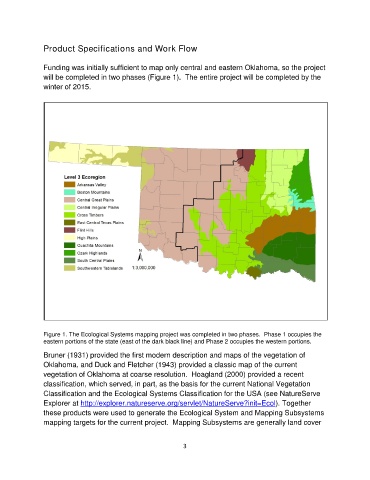
Funding was initially sufficient to map only central and eastern Oklahoma, so the project
will be completed in two phases (Figure 1). The entire project will be completed by the
winter of 2015.
Figure 1. The Ecological Systems mapping project was completed in two phases. Phase 1 occupies the
eastern portions of the state (east of the dark black line) and Phase 2 occupies the western portions.
Bruner (1931) provided the first modern description and maps of the vegetation of
Oklahoma, and Duck and Fletcher (1943) provided a classic map of the current
vegetation of Oklahoma at coarse resolution. Hoagland (2000) provided a recent
classification, which served, in part, as the basis for the current National Vegetation
Classification and the Ecological Systems Classification for the USA (see NatureServe
Explorer at http://explorer.natureserve.org/servlet/NatureServe?init=Ecol). Together
these products were used to generate the Ecological System and Mapping Subsystems
mapping targets for the current project. Mapping Subsystems are generally land cover
3