Attention Non-Residents
The Oklahoma Wildlife Conservation Commission adopted new rules in 2025 that require non-residents accessing certain Oklahoma public hunting and fishing areas to check in and out of the area. By checking in and out of these areas, hunters, anglers, shooters, birdwatchers, hikers and any other users can help the Wildlife Department better understand how the area is being used. There is no additional cost associated with checking in or out of an area. There is no limit to the number of check ins for an individual in a year.

Contacts
Area Details
McClellan-Kerr WRP covers 250 acres in Muskogee county. The WRP is part of the McClellan-Kerr WMA.
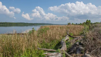
Located along the McClellen-Kerr navigation system the area is mainly river and bottom land habitat with scattered agricultural fields.
Billy Creek Portion
From Wagoner: 4½ miles west on State Hwy 51, 1½ miles south on N4230, 1 mile east on gravel access road.
Chouteau Portion
From Wagoner: 2½ miles west on U.S. Hwy 51, 4 miles south on N4250.
From the Highway 10 and Highway 100 junction in Gore, take Highway 10 southeast for approximately two miles. Turn north to WMA. This accesses the east side of the Lower Illinois River (between the Illinois River and “Deep Branch”) portion of McClellan Kerr (RS Kerr) WMA.
Harkey Island Portion
From Vian: From U.S. Hwy 64 and State Hwy 82 junction, 4 miles east on U.S. Hwy 64, 3 miles south on N4550 to the “T” intersection. Turn west on E1100 and follow into area.
Lower Illinois River Portion - West Side
From Gore: From junction of State Hwy 100 and U.S. Hwy 64, 1½ miles southeast on U.S. Hwy 64, turn north and continue 0.8 miles to WMA access on east (right).
Lower Illinois River Portion - East Side
From Gore: From junction of State Hwy 100 and U.S. Hwy 64, 2 miles southeast on U.S. Hwy 64, turn north to WMA.
Webbers Falls Portion
From Braggs: 2 miles west on E0930.
- Deer: White-tailed deer are present in fair numbers.
- Turkey: Very few Rio Grande turkeys are present.
- Quail: Bobwhite quail are present.
- Rabbit: Cottontail are present in fair numbers and Swamp rabbits can be found in some areas.
- Furbearers: Coyote, bobcat and raccoon are present.
- Dove: The area offers agricultural fields that attract dove.
- Squirrel: Fox and Gray squirrels are present.
- Waterfowl: Usually good duck and goose numbers on and around the area.
- Bald Eagle: Eagles winter on the McClellan-Kerr Navigation system.
Approximately 1,000 acres are planted to row crops on the area, annually. Controlled burns are utilized to manage parts of the area. A 250 acre waterfowl refuge, near Braggs, is managed for waterfowl with a 100 acre wetland unit and fields planted to corn and soybeans, annually.
No camping is allowed on the area. However, the US Army Corps of Engineers has several camping areas near the area.
The McClellan-Kerr navigation system offers good fishing opportunities for catfish species (flathead, blue and channel) as well as black bass.
All shotgun hunting is restricted to federally approved nontoxic shot.
Closed Seasons
Same As Statewide Seasons
Seasons w/ Special Restrictions
- Deer Archery, Dove, Rail, Gallinule, Crow, Quail, Snipe, Woodcock, Duck, Merganser and Coot, Rabbit, Squirrel, Turkey Fall Archery, Pursuit with Hounds for Furbearers, Predator/Furbearer Calling, Trapping
Closed Oct. 15 - Jan. 31.
The discharge of firearms for purposes other than hunting is prohibited.
Public access is prohibited from Oct. 15 - Jan. 31, unless otherwise provided.
No camping allowed.
For One Survey Team, “Getting Skunked” Smells Like Success
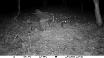
Getting skunks on camera was a critical first step in an Oklahoma State University survey team’s effort to learn more about the Plains spotted skunk population in southeastern Oklahoma. The secretive and little-known skunk was detected at about half of the survey sites on the Ouachita National Forest.
Apprentice Designation: A Learner's Permit for Hunting
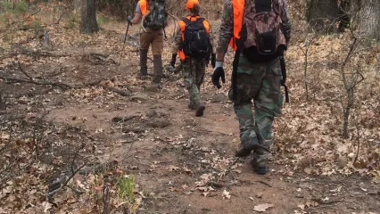
Hunter education has greatly reduced hunting accidents, but if you can’t complete a course right away, the apprentice designation allows you to hunt under supervision. It works like a learner’s permit, giving you the chance to gain real experience safely until you finish hunter education.


