
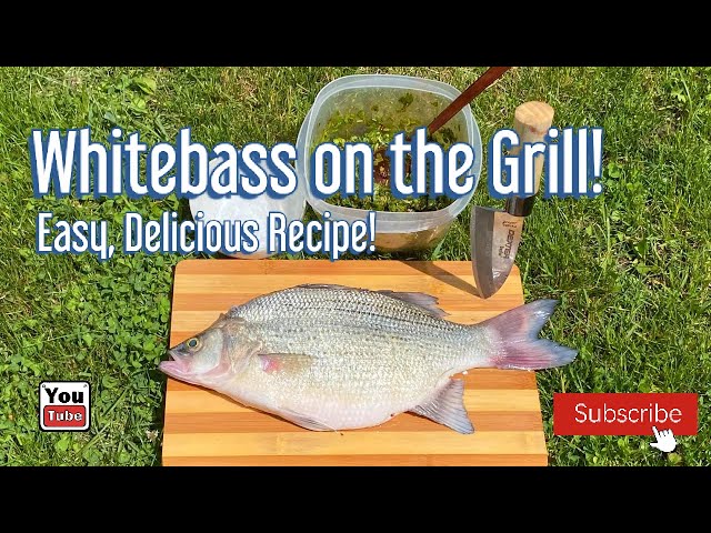
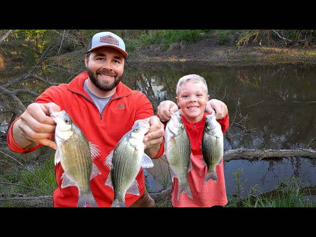
WHITE BASS
The white bass is a fan favorite of springtime anglers. These prolific spawning fish make their annual migration runs in the thousands giving anglers the opportunity to catch fish in bulk. White bass require very basic fishing equipment making them an easy target for anglers of all experience levels!
White bass typically start their spawning routine before the other spring spawning fishes in the state. Longtime white bass anglers claim that the white bass spawning run begins when the redbud trees begin to bloom.
Moderate rainfall and water temperatures between 55°-60°F are key to a prolific river or creek white bass run on a given body of water.
White bass prefer to spawn up inflowing creeks and rivers on a given body of water, but many lakes only have small tributaries necessitating modest rainfall to push the fish upstream. Fish will move as far upstream as water flow allows until satisfactory spawning habitat is found.
During springs with low water levels or lack of rain, spawning schools will be sporadic making for inconsistent fishing days in primetime spots. It's best during these times to stick to staging areas at the mouths of inflows or physical barriers that prevent upstream migration.
Once water temperatures in the lake hit 50˚F, public access sites along creeks and rivers are great places for bank anglers to target white bass.
For boat anglers, start fishing efforts at the mouths of inflowing tributaries and follow the white bass upstream. On a given body of water, there's typically a one to three week window when white bass fishing is excellent. Game Wardens can provide the most up-to-date information on spawning white bass runs in their county.
SPECIES PROFILE
- Oklahoma Distribution
Although native to Oklahoma, white bass were not found in great numbers until large reservoirs were constructed. Now they are found statewide.
- Description
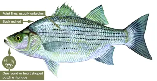
White bass are a member of the temperate bass family, which includes the striped bass, hybrid striped bass, yellow bass, and white perch. White bass are a migratory open‐water fish. They spend most of their lives chasing schools of shad, which are their favorite food. White bass are most active during dawn and dusk. White bass can be identified by the distinctive arched back just behind its head. It also has only one tongue patch (round or heart-shaped). Most white bass average between a half-pound and pound-and-a-half, with potential growth up to five pounds, but rarely exceed three-and-a-half-pounds.
- Habitat
These fish usually travel in large schools. Adults prefer open water during the day and shallow sandy shoals at night. Their reliance on shad as a primary food source neccesitates a transient lifestyle. Unlike other popular game fish species in Oklahoma like bass and crappie that can be predicably found in particular underwater habitat, white bass are always on the move. Anglers should focus on locating shad schools. Focus efforts on wind driven sides of a lake around points, rip rap and coves where shad are likely to be found, especially areas that have rapid depth change or easy access to open water.
- Natural Food Sources
- Shad
- Minnows
- Crustaceans
- Insects
- Spawning
White bass are very prolific. One female can produce up to one million eggs. Reproductive activities are triggered once water temperatures reach 50°F, with peak activity seen around 55°F. Spawning is at random over weeds, debris, shoals, riffles and rocks. When tributary streams are available, this species prefers upstream migration for spawning. When tributary streams are not available, white bass may spawn on top of rocky shoals in a lake or reservoir. No parental care is provided to eggs or young.
They do not build nests or form mating pairs. A female white bass will be followed by a group of male bass that will attempt to fertilize her eggs with their milt immediately after she extrudes them from her body.
Once the eggs are fertilized, adult white bass will normally return to deeper water. Fertilized white bass eggs will hatch in about two days. Juvenile white bass may grow into adulthood within two years.
- Fish Facts
The white bass is Oklahoma's state fish. They are referred to locally as sand bass. An estimated one and a half million pounds of white bass are harvested annually from Oklahoma waters by sport fishermen. Due to their short life span and high reproductive capacity, creel limits are not imposed on most water bodies in Oklahoma. Anglers learn to watch for circling and diving gulls and/or surface disturbances as sure signs of schooling shad. Where there are shad, white bass are usually nearby.
FISHING TIPS
When water temperatures hit 50°F focus your efforts at the mouths of inflowing creeks and rivers on a water body. Mid-March through early-May typically provides the best fishing window for white bass. Key factors to look for during the peak of the spawning run are water temperatures around 55°F and measurable rainfall.
Curly tail grubs, baby shad, paddletail swimbaits, inline spinners, spoons, slabs, Super Dupers, blades, lipless crankbaits, diving crankbaits, jerkbaits and hair jigs in shades of white, silver and/or chartreuse are all effective lures.
The biggest thing with catching temperate bass, such as white bass, that rely so heavily on shad as forage is finding the right size lure. It doesn't matter the type of lure as long as it mimics a shad. More often than not white bass are munching on 1-2" shad, even the bigger fish. Starting off as small as you feel comfortable throwing will put you on more fish more often. It's easy to size up when you're already catching fish, but you can lose confidence quickly when you're not getting bites and you may have the right lure on, just a little too big.
In clear water try white and silver colored lures with dark backs, like black, green and blue if the lure is dual-colored. In stained or muddy water try chartreuse and red patterns.
When fishing with artificial lures, keep a steady retrieve speed, unless vertically jigging. Vertical jigging requires casting or letting line out directly under the boat allowing the spoon or slab to fall to the bottom and pulling the rod tip from a 3 o'clock position to a 12 o'clock position repeatedly, after each pull allowing the spoon or slab to erratically flutter back to the bottom (most bites come during the fall back to the bottom).
You can also use a live worm, minnow or shad on a small- to medium-sized bait holding hook attached to a 12-inch leader line below a barrel swivel and 1/4th up to 1-ounce egg weight depending on wind and current (the more wind and current, the heavier the weight). Let the line off of the reel directly below the boat to your desired depth. If fishing from the bank, you can use the same setup with a slip-bobber float. Try to get your bait within a couple feet of the bottom.
If surface feeding occurs and all you have is live bait, use a fixed-bobber float a foot or two above your hook (remove weight and swivel). Otherwise, switch to artificial topwater lures, such as walk-the-dog lures, propeller lures or poppers.
Fly anglers can find success stripping jig and beadhead flies such as Clouser Minnows and Woolly Buggers in white, chartreuse and shad patterns.
In lakes that do not have inflowing water, try the bait and lure selections described above around coves, points and riprap areas, especially during morning and evening hours on the wind blown side of the water body.
Follow the fish upstream during the spawn and target brushy areas along the bank, riffles, shoals and mouths of connecting tributaries.
White bass are a schooling fish, so if you’re not getting bites using these types of lures/baits change locations often until you find them (typically by finding the shad).
When white bass are not surface feeding, they can usually be found near the bottom. Try to keep your lure or bait near the bottom during the retrieve.
During the pre-spawn and summer patterns, white bass anglers have success vertically jigging spoons and slabs off the bottom over ledges, channel breaks or deep water flats where white bass are congregated. An Oklahoma classic jigging spoon for white bass is the 1/2 ounce Fle-Fly Bendable Minnow in white, red or chartreuse.

Habitat to Target
- Creek & River Mouths - areas of inflowing water to the main lake and connecting tributaries upstream.
- Dam Riprap - morning and evening hours in the summer and fall will see white bass chase bait balls close to the bank.
- Open Water - areas adjacent to transition zones, such as the middle of coves, creek/river mouths or wind blown sides of points.
Rod/Reel Setup
- Medium-Light to Medium rod
- Spinning, spincasting or baitcasting reel
- 6-pound to 12-pound test line
Top Lures
- Lipless Crankbait
1/16th to 1/2 ounce lipless crankbait in a shad or crayfish coloration
- Bargain buy: 2-3/4" 7/16th ounce Bass Pro Shops Tourney Special Rattle Bait in a shad coloration ($3.49)
- Editor's pick: 3" 1/2 ounce Bill Lewis Original Rat-L-Trap in Electric Silver, Sexy Chrome or Tennessee Shad Chrome ($7.39)
Image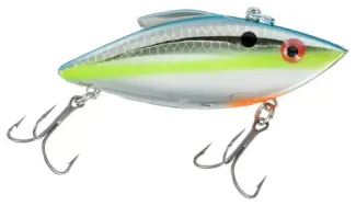
- Lipped Crankbait
Shallow- to medium-diving lipped crankbait in a shad or crayfish coloration
- Bargain buy: 2-1/2" 7/16th ounce Bass Pro Shops Tourney Special Crankbait in a shad coloration ($3.49)
- Editor's pick: 2-1/8" 5/16th ounce Bomber Model A in Chartreuse Blues ($6.99)
Image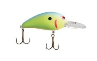
- Curly Tail Grub
2"-3" Curly tail grub in white or chartreuse on a 1/16th to 1/4th ounce jig-head
- Editor's pick/Bargain buy: 2.5" Bobby Garland Stroll'R in Bluegrass paired with a 1/16th ounce jig-head in water 1'-6' deep, 1/8th ounce jig-head in water 6'-12' deep and 1/4th ounce jig-head in water deeper than 12' ($3.99 - 12 pack)
Image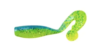
- Swimbait
2"-3" paddletail swimbait in shades of white, blue, pink or chartreuse on a 1/16th to 1/4 ounce jig-head
- Bargain buy: 3" Bass Pro Shops Squirmin' Shad in Citrus Shad, Chartreuse Silver Flake or Baitfish ($3.99 - 15 pack)
- Editor's pick: 2.8" Berkley Powerbait Power Swimmer in Electric Blue Chartreuse paired with a 1/16th ounce jig-head in water 1'-6' deep, 1/8th ounce jig-head in water 6'-12' deep and 1/4th ounce jig-head in water deeper than 12' ($5.99 - 8 pack)
Image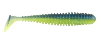
- Hair Jig
1/16th to 1/4th ounce marabou jig or hair jig in white or chartreuse
- Bargain buy: 1/8th ounce Johnson Beetle Bou Marabou Jig in white or chartreuse ($1.79 - 10 pack)
- Editor's pick: 1/8th ounce VMC Dominator Marabou Jig in White ($3.99)
Image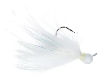
- Road Runner
1/16th - 1/8th ounce Road Runner
- Editor's pick/Bargain buy: 1/16th ounce Road Runner Original Marabou Jig or Road Runner Curly Tail in white or chartreuse ($2.69)
Image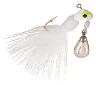
- Inline Spinnerbait
1/16th to 1/4th ounce inline spinnerbait in white or chartreuse
- Editor's pick/Bargain buy: 1/8th ounce Worden's Original Rooster Tail in Hammered Silver White ($3.99)
Image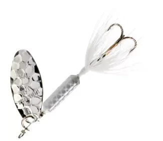
- Topwater
2"-4" topwater lure in a shad coloration
- Bargain buy: 3-1/8" 1/3 ounce Offshore Angler Inshore Special Popper in Green Back/White Belly ($2.69) ($1.79 - 10 pack)
Editor's pick: 3" 1/4th ounce Heddon Zara Puppy in Flitter Shad (for an extra touch tie a 1 foot 6lb up to 10lb test line leader to the rear treble hook and tie on a 1/32nd or 1/16th ounce marabou jig to the end of the leader, known in the fly fishing world as a "dry-dropper" or "hopper-dropper") ($8.49)
Image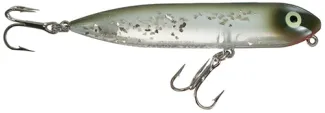
Top Bait
Natural/live bait can be drifted below a bobber or fished near the bottom with weight. Small to medium sized bait-holding hooks are ideal tackle.
- Minnow/Shad
A bucket of minnows from a bait store (typically fathead minnows) or freshly netted shad are the preferred live bait choice of white bass anglers. Use minnows or shad in the 2-inch to 4-inch size range.
Image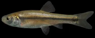 Image
Image
- Crayfish
Family: Cambaridae (freshwater crayfish), in the order Decapoda (shrimp, crabs, and lobsters)
Description: To identify the different species, learn the names of crayfish body parts. Ten appendages are obvious: 4 pairs of walking legs plus 1 pair of pincers (chelipeds) (each pincer has a thumb-like movable finger attached to a “palm”). The body is divided into 2 main parts: at the front is the domelike carapace, comprising both head and thorax and to which the legs attach; and the abdomen, which is the obviously segmented hind part of the body, like the meaty “tail” of a lobster. The shallow indentation between the head and thorax is the cervical groove. At the front of the head are 2 types of “feelers”: 1 pair of antennae (the long ones) and 2 pairs of antennules (the short ones). The triangular extension of the carapace between the eyes is the rostrum.
Size: Depending on species, adult size ranges from 7/8-inch to more than 6 inches (Length excludes antennae and legs).
Image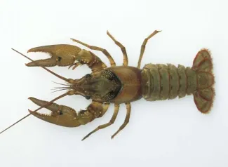
- Short-Horned Grasshopper
Family: Acrididae (short-horned grasshoppers) in the order Orthoptera (grasshoppers, katydids, crickets)
Description: The short-horned grasshopper family includes many familiar jumpers. They are named for their antennae, which are relatively short compared to those in the "long-horned" (katydid) group. The antennae are usually less than half the length of the body and have fewer than 30 segments. Most short-horned grasshoppers are camouflaged with green, olive, tan, brown, or black, though some are quite colorful. Some have colorful wings that only show in flight. The hind legs are specialized for jumping; the mouthparts for chewing.
Like other members of order Orthoptera, short-horned grasshoppers have the first pair of wings long, narrow, fairly thick, and many-veined, functioning as a cover for the second pair, which are membranous and used for flying.
Image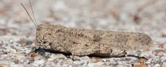
- Cricket
Family: Gryllidae (true crickets) in the order Orthoptera (grasshoppers, crickets, katydids)
Description: Field crickets and house crickets are celebrated singers. There are many species in North America, and they can be hard to tell apart. They have large heads, hind legs adapted for jumping, and stout, unmovable spines on the hind legs. Species may be black, brown, or tan. Adult females have a needlelike (but harmless) ovipositor extending outward from the abdomen; all have a pair of filament-like circi extending from the abdomen (each cercus functions like an antenna).
Members of the genus Gryllus are usually shiny black, and the different species are often best separated by singing pattern. The house cricket, Acheta domesticus, is light brown or tannish overall; the tan head has three dark cross-bands; the wings of adults extend beyond the tip of the abdomen.
Size: Usually ½–1 inch (not counting appendages; varies with species and age of individual).
Image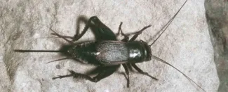
- Red Worm
Known under various common names such as manure worm, brandling worm, panfish worm, trout worm, tiger worm, and red wiggler worm, the red worm is a species of earthworm adapted to decaying organic material. These worms thrive in rotting vegetation, compost, and manure. They are epigean, meaning they crawl on the surface of soil, but are rarely found in soil.
Image
- Nightcrawler
Canadian nightcrawlers are one of the largest commonly available worms. They are sometimes called "dew worms" because they are sometimes found outside in the early morning when there is morning dew still on the ground and nearby plants. The scientific name for them is Lumbricus terrestris. Other names include "lobworm" or just "nightcrawlers." Despite the name, Canadian nightcrawlers are believed to have originated in Europe.
Image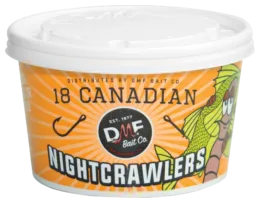
TRY ON THE FLY!
Interested in fly fishing for white bass in Oklahoma? Check out Native Waters Outfitters for guided opportunities this spring. Native Waters Outfitters are proud partners of ODWC's Stars and Stripes Program as well as Project Healing Waters Fly Fishing, a non-profit organization serving wounded military service members at Walter Reed Army Medical Center returning from combat in Iraq and Afghanistan.
Rod/Reel Setup
- 4-weight up to 7-weight fly rod with floating fly line in creeks/rivers and sinking fly line in lakes/reservoirs with a 7.5' 2x up to 0x leader and 1 to 2 feet of 4x up to 0x tippet. If specifically targeting stripers or large hybrid striped bass use a 7-weight up to 9-weight fly rod.
Popular Flies
- Finesse Changer
- Chocklett's Finesse Changer in Shad
Image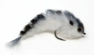
- Clouser Minnow
- Size 2 to size 6 Clouser Minnow in Olive/White
Image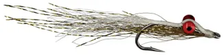
- Woolly Bugger
- Size 4 to size 10 BH Woolly Bugger in White
Image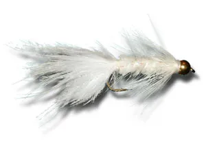
CLEANING TIPS

COOKING TIPS

AREA HIGHLIGHTS
Southwest
- Altus-Lugert
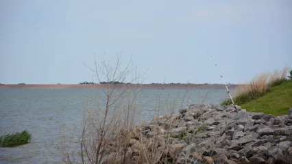
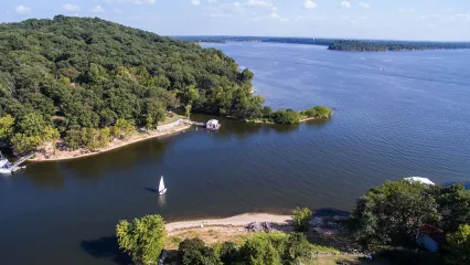
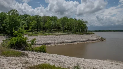
Lake Altus-Lugert
Lake Altus-Lugert impounds the North Fork of the Red River, which is the boundary between Greer and Kiowa Counties. This boundary was contended between Oklahoma and Texas and in 1896 the U.S. Supreme Court decreed that Greer County, which today makes up Harmon, Jackson and Greer Counties, belongs to Oklahoma. The reservoir and adjacent Quartz Mountain Lodge provide a major recreation spot in southwest Oklahoma.
The park offers a variety of recreational activities, and the rugged granite hills and fascinating geologic history promise a unique experience for the hiking enthusiast. Camping and cabin facilities are available at the nearby Quartz Mountain Lodge. Additional facilities include boat ramps, picnic areas, designated campsites, group shelter, restrooms, swimming beach, electric outlets, playground, cabins, enclosed fishing dock, and swimming pool.
Fishing Tips
Submitted by Fisheries Biologist Clayton Porter
This fluctuating lake is good for white bass due to the constant up and down water levels allowing the fish to have good forage year round. There is good access to the lake in most areas along with a beautiful setting and state park there. The locals catch most fish while trolling but many have luck from casting jigs from the bank and around the dam. We ran gill nets there this fall and did find some really nice white bass in our samples. Like most lakes in the state when targeting white bass, I would target areas of gradual sand flats such as Hicks Mountain and all shoreline access points throughout Quartz Mountain State Park around the dam during any period of the year. There are plentiful sand flats here and can be accessed almost anywhere around the lake. A good option would be crankbaits and swimbaits due to not much structure to get caught on and allowing for the bonus walleye or largemouth bass.
Fishing Contact
Game Warden
Operator
Location
Altus-Lugert Lake (Google Map) is located 6 miles southeast of Granite on State HWY 44.
Drive Time
- From OKC - 2.25 hours
- From Tulsa - 3.75 hours
- From Lawton - 1.5 hours
- From Elk City - 45 minutes
Recreational Facilities
Quartz Mountain State Park manages campgrounds, lodge, boat ramp, fishing pier and a designated swimming area.
Find a Fishing Campground
Other Fish Species of Interest
Bait & Tackle Nearby
- Castaway Bait Shop
- Brian's Bait Shop
- Walmart Supercenter
- Roger's Tackle
- Tom Steed Bait Shop
- Lead Babies Slabs
- Walmart Supercenter
- Little Dam Bait Shop
- Porter Hill Bait Shop
- Dj's Bait Shop
Physical Description
- Surface area - 5,089 ac.
- Shoreline length - 32 mi.
- Volume - 122,516 ac. ft.
- Maximum depth - 48.5 ft.
Management Practices
Lake is stocked with channel catfish and walleye.
Altus-Lugert Lake Level Data
USACE Current Lake Level
Additional Information
- Humphreys
 Josh Harris/RPS 2020
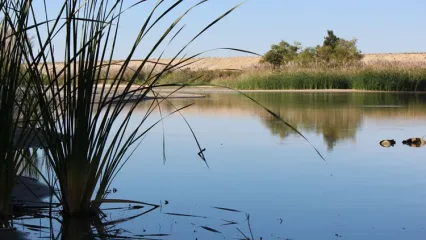
Lake Humphreys
Lake Humphreys is one of four Duncan area reservoirs in south central Oklahoma. Guests to this lake will enjoy 840 acres of recreational space and 17 miles of shoreline. Anglers can fish for largemouth bass from an enclosed, floating fishing dock, or take their boat on the lake using one of three boat ramps. Lake Humphreys also includes 44 RV hookups, a pavilion and a sanitary dump station.
Fishing Tips
Submitted by Fisheries Biologist Clayton Porter
This is one of our best lakes; it has very sizable fish for the size of the body of water and probably our best white bass lake, in my opinion. We have sampled this lake several times over the past two years and have always found good fish along the dam and along the main road that goes to the fishing dock and makes a jetty out into the lake. Locals usually don’t fish for them so it’s an untapped resource. We have found fish on the rocks all times of the year and most of the lake is very easy access for the public and one must have a City of Duncan fishing permit, which can be purchased at the credit/debit card kiosk located at Duncan Lake between the restrooms and pavilion. Permits are also sold at Duncan City Hall, Duncan Police Department and from Lake Patrol.
We have seen the biggest fish in the spring on the rocks of the dam when water temps are between 60°-75°F in water 3'-10’ deep. This lake houses really great spotted bass and saugeye so the bycatch for anglers can be rewarding as well. If I had tips to give, I would try to fish the feeder creeks that enter the lake when the water is rising (anytime of the year, specifically during spring and summer) using some sort of grub or swimbait. The southern boundary of the lake off Gatlin Road has good access to some areas with drops and flat combinations around the dam that white bass may use year round.
Fishing Contact
Game Warden
Operator
Location
Lake Humphreys (Google Map) is located 6.5 miles southeast of Marlow on State HWY 29 and Scott Rd.
Drive Time
- From OKC - 1.5 hours
- From Tulsa - 2.75 hours
- From Lawton - 40 minutes
Recreational Facilities
City of Duncan manages campgrounds w/ full RV hookup, boat ramps and fishing pier.
Find a Fishing Campground
Other Fish Species of Interest
Bait & Tackle Nearby
- Walmart Supercenter
- Down & Out Bait & Tackle
- Claphans Corner
- Walmart Supercenter
- Walmart Supercenter
- Ralph's Resort
- Porter Hill Bait Shop
- Dj's Bait Shop
- Little Dam Bait Shop
- Walmart Supercenter
Physical Description
- Surface area - 882 ac.
- Shoreline length - 16.1 mi.
- Volume - 14,041 ac. ft.
- Maximum depth - 40.4 ft.
Additional Information
- Lawtonka
Lake Lawtonka
Fed by streams from the Wichita Mountains, Lake Lawtonka is located just north of Lawton. With 2,398 acres and 21 miles of shoreline, this lake is great for swimming, boating and a variety of water sports. Overnight campsites and picnic facilities are available at both East Campground and Robinson's Landing. Lawtonka's two campgrounds include hot showers and bathrooms on site, a marina with grocery and gas station close by. A day-use swimming beach is also available. Lake Lawtonka guests can also enjoy nearby Medicine Park and Mount Scott.
Fishing Tips
Submitted by Fisheries Biologist Clayton Porter
Always a hot spot for white bass, specifically in the spring when the bass head up Medicine Creek and Canyon Creek to spawn is when most anglers target Lawtonka.
There are a few folks that will fish for them in the winter around the boat ramps and docks.
The most enjoyable aspect about Lawtonka and white bass is the summer time top water action; late evenings are a blast with small poppers and Mann's The Little George spoons. Most of the top water action in the summer will be along the south bank of the lake around the dam and school house slough area.
My favorite baits here are bright colored sassy shad and grubs. During the summer months a local favorite spot is on the east side of the lake at the inlet structure where the city of Lawton pumps in water from Lake Ellsworth.
Like Altus-Lugert, the west bank of Lawtonka is a large gradual sand flat they will cruise looking for shad.
There is a good population of smallmouth and largemouth bass here as well, so those bonus fish can be caught in most areas when targeting white bass.
There is good bank access around most of the lake and anglers need to purchase a city of Lawton license at Bubbas Gas and Shop or School House Slough.
A City of Lawton permit is required fishing and boating. Click here for costs and where to purchase locations.
Fishing Contact
Game Warden
Operator
Location
Lake Lawtonka (Google Map) is located just north of Medicine Park on SH 58.
Drive Time
- From OKC - 1.25 hours
- From Tulsa - 2.75 hours
- From Lawton - 20 minutes
Recreational Facilities
City of Lawton manages campgrounds, a boat ramp and designated swimming areas.
Find a Fishing Campground
Other Fish Species of Interest
Bait & Tackle Nearby
- Walmart Supercenter
- Down & Out Bait & Tackle
- Claphans Corner
- Walmart Supercenter
- Walmart Supercenter
- Ralph's Resort
- Porter Hill Bait Shop
- Dj's Bait Shop
- Little Dam Bait Shop
- Tom Steed Bait Shop
Physical Description
- Surface area - 2,324 ac.
- Shoreline length - 19.2 mi.
- Volume - 55,171 ac. ft.
- Maximum depth - 58.4 ft.
Lawtonka Lake Level Data
Additional Information
Northwest
- Canton
Canton Lake
Canton Lake has great access and facilities for boaters and bank anglers alike. Gently sloping sandy beaches can be found at all of the public access areas. Fishing jetties along the dam and a new recreation area below the dam offer bank anglers easy access to some of the best fishing at the lake.
Renowned as Oklahoma's premier walleye fishery, Canton Lake also supports a robust population of crappie, white bass and catfish.
Canton Lake has become the primary source of walleye eggs for incubation and stocking of other state lakes. Since 1968, community leaders and local merchants have promoted an annual Walleye Rodeo. The four-day event offers visitors the chance to win cash and other prizes that total over $30,000. The community also hosts other festivities which attract fishermen from Oklahoma and surrounding states.
Fishing Tips
Submitted by Fisheries Biologist Luke Taylor
Although this lake is widely known for its walleye fishing, it is also a great destination for white bass. These fish can be caught in the lake throughout the year, schooling up with the hybrid striped bass, chasing shad. When temps reach 50°F, the white bass begin running up the North Canadian River to spawn.
From March through May, these fish will congregate in the river in high numbers, making them an easy target for anglers. A variety of jigs and lures can be used to catch these fish including curly tail jigs, lipless crankbaits, marabou jigs, and about anything else in your tackle box that looks like a minnow. Canton WMA offers a few primitive access points along the river (N2380, N2400 North, N2400 South, N2430, N2440) to unload small boats, canoes, and kayaks, but walking the banks may be tough due to thick vegetation.
During times of high water discharge through the dam, white bass can be found stacked up in the stilling basin. Bank access to the stilling basin can be found here. Bonus bycatch can be walleye, hybrid striped bass, crappie and catfish.
Fishing Contact
Game Warden
Operator
Location
Canton Lake (Google Map) is located 2 miles north of Canton and 18 miles southwest of Fairview on Highway 58.
Drive Time:
- From OKC - 1.75 hours
- From Tulsa - 3 hours
- From Weatherford - 50 minutes
Recreational Facilities
U.S. Corps of Engineers manages campgrounds with full RV hookups, boat ramps and swimming beaches. Canton WMA offers primitive access to the North Canadian River.
Find a Fishing Campground
Other Fish Species of Interest
Bait & Tackle Nearby
- Gilchrist General Store
- Roman Nose General Store
- Walmart Supercenter
- Walmart Supercenter
- Walmart Supercenter
- Atwoods
- Academy
- Walmart Supercenter
- Walmart Supercenter
- Walmart Supercenter
Physical Description
- Surface area - 7,910 ac.
- Shoreline length - 37.8 mi.
- Volume - 111,310 ac. ft.
- Maximum depth - 35.2 ft.
Management Practices
Fall gillnetting every year to evaluate fish population. Cedar trees are added to refurbish existing habitats.
Canton Lake Level Data
North Canadian River CFS Data
Additional Information
- Fort Supply
Ft. Supply Lake
Fort Supply Lake is a popular recreation area with several white sandy beach areas, RV and tent camping, fishing, boating, swimming and picnic areas. Other facilities include boat ramps, group shelters, restrooms, showers and playgrounds. Anglers visiting this 1,800 acre lake will enjoy crappie, largemouth white bass, walleye and several species of catfish.
Fishing Tips
Submitted by Fisheries Biologist Luke Taylor
This lake is a great fishing destination and is widely known for its abundant white bass numbers.
Anglers can enjoy catching white bass throughout the year on wind blown banks of the lake, but the best time of year to target these fish is in the spring.
When water temps reach 50°F, the sand bass start to move into shallow water and up Wolf Creek, congregating in great numbers, making them an easy catch. Usually this occurs from mid- to late-March into May, depending on the year.
During this time, anglers of all skill levels will be able to sack up these bass using marabou jigs, lipless crankbaits, roadrunners, and anything else that mimics a minnow.
There are a few walk-in spots along Wolf Creek (Spot 1, Spot 2, Spot 3, Spot 4) to access through Ft. Supply WMA (WMA Map).
Fishing Contact
Game Warden
Operator
Location
Ft. Supply Lake (Google Map) is located 1 mile south of Ft. Supply and 12 miles northwest of Woodward.
Drive Time
- From OKC - 2.75 hours
- From Tulsa - 3.75 hours
- From Woodward - 25 minutes
Recreational Facilities
U.S. Corps of Engineers manages campgrounds with full RV hookups, boat ramps and swimming beaches.
Find a Fishing Campground
Other Fish Species of Interest
Bait & Tackle Nearby
- Walmart Supercenter
- Walmart Supercenter
Physical Description
- Surface area - 1,820 ac.
- Shoreline length - 17 mi.
- Volume - 13,900 ac. ft.
- Maximum depth - 32.5 ft.
Management Practices
Fall gillnetting every other year to evaluate fish population. Cedar trees are added to refurbish existing habitats.
Ft. Supply Lake Level Data
Additional Information
North-Central
- Kaw
Kaw Lake
Kaw Lake is located in north central Oklahoma, approximately 8 miles east of Ponca City on the Arkansas River. Ground breaking ceremonies were held in May 1966 and impoundment of the reservoir occurred in 1976. Construction on the recreation facilities concluded in July of 1980 with the completion of the Osage Cove Public Use Area.
There are nine public use areas and two lake access points located around the lake for visitors to enjoy. Campers can select from over 300 family campsites, many of which are equipped with water and electric hookups. Groups of all types enjoy four group camping areas, three of which are located at the Osage Cove Public Use Area and one located at the Sarge Creek Cove Area. Use of the group camping areas is by reservation only. Interested parties can contact the Kaw Lake Office for reservations.
Ten boat launching ramps provide boaters with easy access to Kaw Lake. Once on the water, boaters can find two full service marinas located at McFadden Cove and Pioneer Park. Swimmers are invited to enjoy designated swimming areas at Pioneer Park and Sandy Park.
Kaw Lake and the Arkansas River have long been known for producing some of Oklahoma's largest catfish. Kaw Lake also offers anglers excellent opportunities to catch crappie, white bass and walleye
Fishing Tips
Submitted by Fisheries Biologist Jeremy Duck
Little Beaver Creek offers a couple good public bank access locations (Spot 1 & Spot 2) as well as a boat ramp.
Spawning runs typical take place when water tempertaures are between 58°-62°F, usually around the last week of March.
The Newkirk Bridge offers public access on both sides (West Side & East Side) of the Arkansas River, these are primitive weather affected dirt roads, 4-wheel drive and caution needed to access both. There is also an old boat ramp up the road.
Productive lures include white curly tail grubs, white or chartreuse baby shad and white inline spinners.
If you're in a boat, Kaw Lake elevation needs to be at least 1012 to get above the first riffle on Little Beaver Creek.
Fishing Contact
Game Warden
Operator
Location
Kaw Lake (Google Map) is located 11 miles east of Ponca City on SH 11.
Drive Time
- From OKC - 1.75 hours
- From Tulsa - 1.5 hours
- From Ponca City - 15 minutes
Recreational Facilities
U.S. Corps of Engineers manages campgrounds and boat ramps. Easy access to the water's edge is available in many of the public-use areas. The concrete walk along the spillway is also accessible.
Find a Fishing Campground
Other Fish Species of Interest
Bait & Tackle Nearby
- Lakeview Campground, Boat Storage, Bait Shop & Store
- Walmart Supercenter
- Grit & Grace Outdoors
- Bubba's Outdoor Sports
- Academy
- Lake McMurtry West Bait Shop
- Keystone Lake Bait & Store
- Walmart Supercenter
- Walmart Supercenter
- Cowboy Corner at Lake Carl Blackwell
Physical Description
- Surface area - 23,610 ac.
- Shoreline length - 149 mi.
- Volume - 428,600 ac. ft.
- Maximum depth - 74.5 ft.
Management Practices
Walleye are stocked and brush piles are put into the lake for fish habitat.
Kaw Lake Level Data
Additional Information
Northeast
- Arkansas River
 Steve Mullen/RPS 2018
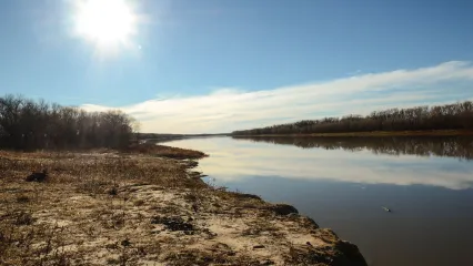
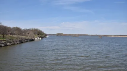
Arkansas River
The Arkansas River begins at the base of Keystone Lake dam and has public access points for several miles downstream to the city of Jenks.
Fishing Tips
Submitted by Fisheries Supervisor Josh Johnston
The hard part about this task is not identifying good white bass fisheries, but those with public bank access.
Here around Tulsa, there is very little public stream access, however, folks can access the Arkansas River from river parks property and trails. The Arkansas River is a great place to catch white bass, as well as sauger and striped bass throughout much of the spring.
When water temperatures reach 50°F, grab a rod and reel and an assortment of swimbaits, and you are sure to catch something. The best places to start are around bridges, channel bends and where riffles are present.
There are public access points for several miles downstream to the city of Jenks. These areas include:
- Keystone Dam West
- Keystone Dam East
- Swift Park Boat Launch
- Case Community Park Boat Launch
- River West Festival Park
- River Parks Kayak Access
- River Parks East Trail
- River Parks
- Turkey Mountain Urban Wilderness
- Helmerich Park
- E 96th St Bridge
Fishing Contact
Game Warden
Operator
Location
The Arkansas River in Tulsa (Google Map) begins at the base of Keystone Lake just west of downtown.
Drive Time:
- From OKC - 1.75 hours
- From Tulsa - 10 minutes
- From Stillwater - 1 hour
Recreational Facilities
U.S. Corps of Engineers and Oklahoma State Parks manages campgrounds with full RV hookups, boat ramps and designated swimming areas around Keystone Lake.
Find a Fishing Campground
Other Fish Species of Interest
Bait & Tackle Nearby
- Bait Shop
- Woody's Bait & Tackle
- Keystone Lake Bait & Store
- Walmart Supercenter
Keystone Lake Level Data
Arkansas River CFS Data
- Grand
 Tom Whipple/RPS 2018
Grand Lake
Operated by the Grand River Dam Authority (GRDA), Grand Lake is one of Oklahoma's premier fisheries. Grand Lake has hosted two Bassmaster Classics (2013, 2016) and MLF Redcrest (2022). It is a renowned largemouth bass fishery, but boasts robust populations of catfish, crappie, white bass and paddlefish. Being a destination fishery, Grand Lake offers ample lodging and accommodations.
Fishing Tips
Submitted by Fisheries Technician Kendall Robbins
Grand Lake is a must stop destination when it comes to chasing white bass in the spring months. March through late-April are usually the peak months for chasing the spring time white bass during their spawning runs. There are several tributaries in the Grand Lake watershed that would be good during these months.
There are two major rivers that come together at Twin Bridges State Park, the Spring River and Neosho River. The white bass utilize both of these rivers during their spawning runs, although the Spring River tends to be the springtime hotspot. There are a few access points on the bank that can be accessed on both rivers.
On the Neosho River, you can access the fishery at Connors Bridge and Miami Park (West & East). Both of these places are hot spots for Paddlefish during the same months.
The Spring River has public bank access points at Highway 10 and Devils Promenade, both of which have boat ramps. Baby shad, curly tail grubs, hair jigs and shallow- to medium-diving crankbaits are the way to go. You can also throw an Alabama Rig if you’re into catching them two or three at a time. Depending on water clarity, usual go to colors are white, chartreuse and black.
Bomber Model A crankbaits with blue, yellow and/or orange are a local expert’s favorite. It's called Chartreuse Blues and it is exceedingly hard to find on the market.
Fishing Contact
Game Warden
Operator
Location
Grand Lake (Google Map) is located 15 miles east of I-44 in between US 60, SH 82, SH 28, SH 10 and US 59.
Drive Time
- From OKC - 3 hours
- From Tulsa - 1.25 hours
- From Miami - 15 minutes
Recreational Facilities
Grand River Dam Authority and Oklahoma State Parks manage campgrounds with full RV hookups, boat ramps, fishing docks and designated swimming areas.
Find a Fishing Campground
Other Fish Species of Interest
Bait & Tackle Nearby
- Blue Water Bait & Tackle
- Benge Creek Outfitters
- Blue Moon Bait & Tackle
- Ketch-um Bait Shop
- Honey Creek Outdoors
- Grand Lake Sports Center
- Walmart Supercenter
- Littlefield's Sporting Goods
- Fairland Bait & Tackle
- Shawnee Grocery
- Walmart Supercenter
Physical Description
- Surface area - 41,749 ac.
- Shoreline length - 460 mi.
- Volume - 1,515,414 ac. ft.
- Maximum depth - 133 ft.
Management Practices
Hybrid striped bass are regularly stocked.
Grand Lake Level Data
Spring River CFS Data
Neosho River CFS Data
Additional Information
- Hudson
Hudson Lake
Operated by Grand River Dam Authority (GRDA). Snowdale Area of Grand Lake State Parks is located North of Highway 20 on the Wolf Creek arm of Hudson Lake. This State Park is located just west of Salina and has a public boat ramp. The Lions Club ramp is open to public access; it is found just north of the highway 20 Bridge in Salina. There are also public access ramps on the North end of Kerr Dam, south of Salina on the west side of Highway 82 north of the 82 bridge, Ray's cove on the west side of Strang, and the Horseshoe which is on the west side of the lake across from Spavinaw Creek.
Fishing Tips
Submitted by Fisheries Biologist Brad Johnston
Hudson Lake has a great white bass population, with the most popular spot for catching them being all the way upstream at Pensacola dam. Pensacola dam is a hydro power dam used by GRDA, so there is often generation occurring. This inflow of water brings white bass up to the dam from early March through June in a normal year. The peak numbers are generally in April, but it can be great fishing for a much longer period than other tributaries that rely strictly on spring rains to pull the white bass upstream.
There are many different lures you can catch them on, and this area seems to do well with natural shad colors. Some good choices to start with are soft plastics such as sassy shad and curly tail grub, lipless crankbaits, shallow diving crankbaits, marabou jigs, bucktail jigs, and inline spinners. Keep in mind that these fish are drawn to this point because of the water flow so it can lead to some great fights with the water current. It’s a lot of fun to land these fish on light tackle, but be prepared for the fight of your life when it’s a 10+ pound hybrid striped bass on the end of your line (these ARE NOT uncommon and might call for a slightly heavier setup to land regularly). This location boasts some of the only public bank access in the area. You can fish the bank (some banks are steep and eroded) on the east side of the river from the cable just below the dam downstream for about 1 1/3 mile.
There are several spots along the gravel access road that have good access to the bank. If you have access to a boat it opens up a lot more area to fish in that stretch of the river downstream of the dam. Having a boat will also open up options for a couple other tributaries of Hudson Lake such as Big Cabin Creek and Rock Creek. These creeks will be reliant upon those spring rains to pull those spawning fish up into the tributaries.
Peak times in these areas are generally mid-March through mid-April. The water in the creek will generally be more turbid so keep that in mind when choosing a lure color (chartreuse, white, black and blue are solid options).
Blue/white or pink/white bucktail jigs drifted below a bobber catch hybrid striped bass and white bass well when the bite is tough.
Fishing Contact
Game Warden
Operator
Location
Lake Hudson (Google Map) is located just west of Salina on SH 20.
Drive Time
- From OKC - 2.5 hours
- From Tulsa - 1 hour
- From Muskogee - 1 hour
Recreational Facilities
Grand River Dam Authority manages boat ramps.
Other Fish Species of Interest
Bait & Tackle Nearby
- Hudson Lake Marina (33 Big Bluff Rd, Pryor, OK 74361)
- Big Daddys Lures (7339 S 437, Locust Grove, OK 74352)
- Gibson Bait & Tackle (305 N Wyandotte St, Locust Grove, OK 74352)
- Blue Water Bait & Tackle (235 W MAIN ST DISNEY 528, Disney, OK 74340)
- Benge Creek Outfitters (291 West W Broadway Ave, Langley, OK 74350)
- Blue Moon Bait & Tackle (448820 East, OK-85, Ketchum, OK 74349)
- Walmart Supercenter (4901 S Mill St, Pryor, OK 74361)
Physical Description
- Surface area - 11,029 ac.
- Shoreline length - 143.3 mi.
- Volume - 200,185 ac. ft.
- Maximum depth - 65 ft.
Management Practices
Hybrid striped bass are regularly stocked.
Hudson Lake Level Data
Additional Information
East-Central
- Ft. Gibson
 Casey Taft/RPS 2021
Ft. Gibson Lake
Operated by the U.S. Army Corps of Engineers. Impounded in 1953 Ft. Gibson is the last lake in the Grand River chain and is subject to drastic lake level fluctuations. Located near Wagoner, Ok, Ft. Gibson Lake can be accessed through numerous USACE areas and two state parks, and it is very popular for all types of recreation.
Ft. Gibson is a highly productive lake, where the Ozarks meet the central irregular plains. Rocky bluffs and outcrops dominate the east side of the lake, and shallower with gradual slopes on the west side.
Fishing Tips
Submitted by Fisheries Biologist Jon West
Long known as a top white bass destination, the upper end of Ft. Gibson Lake and its larger feeder creeks is host to the mass migration of white bass making their annual spawning run. The mouths of Spring Creek, Chouteau Creek and Pryor Creek offer good fishing from March through May.
Trolling is a good way to locate schools of white bass. Once you catch a fish or two trolling then you can concentrate your fishing in the area where you hooked up. Also, looking for surface action of fish feeding or spawning can help to locate schools of white bass.
Spawning white bass often stack up at the low water dam when the water level makes it impassable to them. Always carry an extra rod and reel tied up and ready to fish so when the action is hot you can quickly get back to catching fish if you break your first line.
Having 1/8 oz jig-heads and 3” curly tail grubs in a variety of colors is an essential bait for spring white bass fishing. To help increase your odds you can tie a double jig rig and be fishing two different depths simultaneously. It also allows for the possibility of a double hook up!
Lipless crankbaits can be very effective in catching white bass. The vibrating motion and internal rattle help attract nearby fish and can increase their aggression and cajole them into biting. You’ll want to favor baitfish patterns and chartreuse is always an effective color. Other popular lure options that can bring success include in-line spinners such as rooster tails or mepps, spoons, crankbaits and jerkbaits.
Fishing Contact
Game Warden
Operator
Location
Fort Gibson Lake (Google Map) is located 7 miles east of Wagoner on SH 51.
Drive Time
- From OKC - 2.5 hours
- From Tulsa - 1 hour
- From Muskogee - 40 minutes
Recreational Facilities
U.S. Corps of Engineers and Oklahoma State Parks manage campgrounds with full RV hookups, boat ramps and designated swimming areas.
Find a Fishing Campground
Other Fish Species of Interest
Bait & Tackle Nearby
- Bait Masters
- Mater's Bait & Tackle
- Pokey's Trading Post Bait & Tackle Shop
- Walmart Supercenter
- Big Daddys Lures
- Gibson Bait & Tackle
Physical Description
- Surface area - 19,896 ac.
- Shoreline length - 211 mi.
- Volume - 306,133 ac. ft.
- Maximum depth - 60.2 ft.
Management Practices
Crappie have a 10" minimum and daily limit of 15.
Ft. Gibson Lake Level Data
Neosho River CFS Data
Additional Information
- Tenkiller
Lake Tenkiller
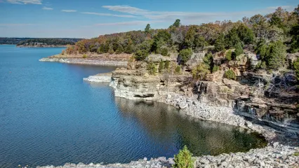
Impounded in 1952, Lake Tenkiller is the only controlled impoundment on the Illinois River and can experience prolonged lake level fluctuations. Situated in the Ozark highlands, Lake Tenkiller is a deep, clear lake dominated by a shoreline with rocky bluffs and outcroppings. There are numerous public access areas, including two state parks. Lake Tenkiller is very popular for all types of recreation. Due to its depth, the lake provides cool water for the popular year-round trout fishery in its tailwater.
Fishing Tips
Submitted by Fisheries Biologist Jon West
Trolling is a good way to locate schools of white bass. Once you catch a fish or two trolling then you can concentrate your fishing in the area where you hooked up. Also, looking for surface action of fish feeding or spawning can help to locate schools of white bass. Always carry an extra rod and reel tied up and ready to fish so when the action is hot you can quickly get back to catching fish if you break your first line.
Having 1/8 oz jig heads and 3” curly tail grubs in a variety of colors is an essential bait for spring white bass fishing. To help increase your odds you can tie a double jig rig and be fishing two different depths simultaneously. It also allows for the possibility of a double hook up!
Lipless crankbaits can be very effective in catching white bass. The vibrating motion and internal rattle help attract nearby fish and can increase their aggression and cajole them into biting. You’ll want to favor baitfish patterns and anything with chartreuse is always an effective color. Other popular lure options that can bring success include in-line spinners such as rooster tails or mepps, spoons, crankbaits and jerkbaits.
Fishing Contact
Game Warden
Operator
Location
Lake Tenkiller (Google Map) is located 10 miles south of Tahlequah on US 82 and S Indian Rd.
Drive Time
- From OKC - 2.75 hours
- From Tulsa - 1.5 hours
- From Muskogee - 45 minutes
Recreational Facilities
U.S. Corps of Engineers and Oklahoma State Parks manage campgrounds with full RV hookups, boat ramps and designated swimming areas.
Find a Fishing Campground
Other Fish Species of Interest
Bait & Tackle Nearby
- Dave's Bait & Tackle
- Jimmy Houston Outdoors Store
- Walmart Supercenter
- Walmart Supercenter
- Mike's Outdoors
- Dunham's Sports
- Walmart Supercenter
- Bait Barn
- Mater's Bait & Tackle
- JJ's Bait Shop
Physical Description
- Surface area - 12,900 ac.
- Shoreline length - 170 mi.
- Volume - 654,100 ac. ft.
- Maximum depth - 129 ft.
Management Practices
Crappie must be a minimum of 10-inches and have a daily limit of 15.
Tenkiller Lake Level Data
Additional Information
Southeast
- Broken Bow

Broken Bow Lake
Tucked away in the foothills of the Ouachita Mountains, this 22-mile long lake in southeastern Oklahoma and its crystal blue waters provide a variety of water recreation opportunities. Grab a pole and try your hand at reeling in a trophy-worthy trout from the fresh mountain-fed water. The clear waters of the 14,000-acre Broken Bow Lake are also a favorite haunt of scuba divers. From wild and thrilling to serene and tranquil, you’ll find kayaking, rafting and canoeing adventures in some of the most stunning settings here.
Amidst the unusual beauty, outdoor enthusiasts can discover picturesque views available from the calm blue waters at Beavers Bend State Park, located along the Mountain Fork River just below the dam, with a boat or canoe rental as you explore 180 miles of the lake's shoreline. The water beckons for a stay right on the lake in a houseboat or a thrilling Jet Ski ride. Beavers Bend State Park provides cabins and many other recreational facilities just offshore. Densely forested mountain terrain offers shelter for a variety of wildlife for nature enthusiasts and bird watchers to enjoy.
Fishing Tips
Submitted by Fisheries Biologist David Bogner
Carved into the steep hillsides of the Ouachita Mountains, Broken Bow reservoir offers stunning views and white bass fishing. The best fishing for the spring run is on the Mountain Fork River at the shoals and at the narrows both of which offer bank access. The narrows via the low water crossing, and the shoals via HWY 259 & 54300 Rd (NOTE: must park on side of road, the 2 mile forest service road, located on the left hand side of 54300 Rd 0.1 mile from HWY 259, down to the river is closed to vehicle traffic and is walk in only). Boats can be launched at an unofficial boat ramp at Panther Creek or at the concrete ramp at the McCurtain County Wilderness Area for easy water access to the shoals.
Cover water until you find a school. Don’t be afraid to change it up or move on if you cant get a bite. Fisheries staff sampled 80 fish in 10 minutes but only 3 fish on hook and line between 3 anglers in 20 minutes, you can't make them bite. Use sufficiently heavy line as hybrid striped bass run up with the white bass as do walleye, with a 7-pound walleye and 10-pound hybrid striped bass showing up in our sample.
I recommend Kastmaster spoons, Super Dupers, inline spinners or hard plastics like a shad rap. Jigs can also be effective. Silver is the preferred color for spoons and spinners as they mimic shad. If using a jig use something with some flash.
Success can be had utilizing worms or minnows beneath a bobber.
Fishing Contact
Game Warden
Operator
Location
Broken Bow Lake (Google Map) is located 9 miles northeast of Broken Bow off of US 259.
Drive Time
- From OKC - 4 hours
- From Tulsa - 3.75 hours
- From McAlester - 2.25 hours
- From Durant - 2.25 hours
Recreational Facilities
U.S. Corps of Engineers and Oklahoma State Parks manage campgrounds with full RV hookups, boat ramps, state park cabins, hiking trails and designated swimming areas.
Find a Fishing Campground
Other Fish Species of Interest
Bait & Tackle Nearby
- Beavers Bend Marina
- Hookers Live Bait Fire & Ice
- Beavers Bend Fly Shop
- Walmart Supercenter
- Walmart Supercenter
- JC's Store
- Red Barn Propane - Bait, Tackle
- Walmart Supercenter
- Sardis Lake Custom Lures
- D&J Bait N Grub
Physical Description
- Surface area - 14,200 ac.
- Shoreline length - 220 mi.
- Maximum depth - 169 ft.
- Volume - 918,070 ac. ft.
Broken Bow Lake Level Data
Mountain Fork River CFS Data
Additional Information
- Eufaula
 Shi Annlngalls/RPS 2019
Eufaula Lake
Eufaula Lake, the largest reservoir in Oklahoma at 105,500 surface acres, was impounded in 1964. It is operated by the United States Army Corps of Engineers for the purposes of flood control, water supply, hydroelectric power and navigation. Historically, water level fluctuations, turbidity and siltation have created management challenges.
A 14-inch minimum length limit on black bass was enacted in 1987 to increase the number of spawning size bass in the lake. Florida strain largemouth bass were first stocked in the 1980s and continue to be stocked frequently. Reservoir-strain smallmouth bass were first stocked in the lake in 1992 and stockings continued until 1998. Eufaula Lake is an excellent crappie, white bass and catfish fishery.
Fishing Tips
Submitted by Fisheries Biologist Michael Hollie
Our best year-round white bass fishing destination in the Central Region Management Area and one of the top destinations in the state, schools of white bass can be found throughout the lake. At 105,500 surface acres, 800 plus miles of shoreline, numerous boat ramps and bank fishing locations including 16 U.S. Army Corps of Engineers managed recreation areas, six wildlife management areas, and two state parks.
The sheer number of tributaries that feed Eufaula make it difficult to nail down the spring running locations. White bass will start getting active at 50°F and will spawn around 55°F. Target the tributaries that have increased inflow from spring rains. The southern end of the lake will warm up faster than the north, so start efforts in the Gaines Creek Recreation Area and move north as water temperatures increase.
Targeting the staging white bass can be another fishing opportunity. White bass can be found in the mouths of creeks and rivers during the pre and post-spawn. Pre-spawn white bass will be schooled up in deep water waiting for water temps to reach 50°-55°F.
Fishing Contact
Game Warden
Operator
Location
Eufaula Lake (Google Map) is located 10 miles south of I-40 on US 69.
Drive Time
- From OKC - 2 hours
- From Tulsa - 1.5 hours
- From Henryetta - 40 minutes
Recreational Facilities
U.S. Corps of Engineers and Oklahoma State Parks manage campgrounds with full RV hookups, boat ramps, marinas, designated swimming areas and trails for hiking, biking, equestrian and ATVs. Eufaula Lake State Park (918) 689-5311 and Belle Starr Marina (918) 689-2132 offer an enclosed fishing dock.
Find a Fishing Campground
Lake Eufaula State Park (Arrowhead Area)
Other Fish Species of Interest
Management Practices
Florida strain largemouth bass are stocked frequently. Fish attractors are maintained to help increase angler success.
Bait & Tackle Nearby
- Eufaula Cove Marina
- Flamingo Fish & Marine
- B & B Bait & Tackle
- Belle Starr Marina
- Newman Wholesale Fishing Tackle Distribution
- Lake Eufaula Marina
- Lakeside One Stop
- Double K Bait & More
- Walmart
- Walmart Supercenter
Physical Description
- Surface area - 105,500 ac.
- Shoreline length - 833.9 mi.
- Maximum depth - 90.2 ft.
- Volume - 2,330,000 ac. ft.
Eufaula Lake Level Data
Additional Information
- Hugo
Hugo Lake
Located in scenic southeastern Oklahoma, this long-established recreation destination offers family fun, boating, abundant fishing opportunities and spectacular sunset views.
Fishing Tips
Submitted by Fisheries Biologist David Bogner
Best boat ramps would be Rattan Landing on the upper end of Hugo/Kiamichi river and the WMA boat ramp on the lower end of the river just down from the highway bridge.
I recommend Kastmaster spoons, Super Dupers, inline spinners or hard plastics like a shad rap. Jigs can also be effective. Silver is the preferred color for spoons and spinners as they mimic shad. If using a jig use something with some flash.
Success can be had utilizing worms or minnows beneath a bobber.
Fishing Contact
Game Warden
Operator
Location
Hugo Lake (Google Map) is located 7 miles east of Hugo on US 70.
Drive Time
- From OKC - 3 hours
- From Tulsa - 2.5 hours
- From Durant - 1 hour
Recreational Facilities
U.S. Corps of Engineers and Little Dixie Community manage campgrounds with full RV hookups, cabins, boat ramps, designated swimming areas and trails for hiking, biking, and equestrian.
Find a Fishing Campground
Other Fish Species of Interest
Bait & Tackle Nearby
- Red Barn Propane - Bait, Tackle
- Walmart Supercenter
- JC's Store
- Walmart Supercenter
- Walmart
- Hookers Live Bait Fire & Ice
- Beavers Bend Marina
- Playin Hooky Bait Tackle and More
- Sardis Lake Custom Lures
Physical Description
- Surface area - 11,592 ac.
- Shoreline length - 98.6 mi.
- Maximum depth - 51.5 ft.
- Volume - 126,741 ac. ft.
Hugo Lake Level Data
Additional Information
- Sardis

Sardis Lake
With 117 miles of scenic southeastern Oklahoma shoreline, Sardis Lake is located five miles north of Clayton along Oklahoma Highway 2 in beautiful Choctaw Country. The lake covers 14,360 acres and offers many opportunities for a variety of outdoor recreation including skiing and boating. There are three campgrounds located around the lake offering various facilities including general hookups, restrooms, showering facilities, playground, swim beach, boat ramps and fishing docks.
The lake also has facilities for group camping and picnic areas, electricity and large outdoor cooking grills. Although Sardis Lake is known for producing several of Oklahoma's largest bass, the stocked lake also provides fishermen excellent opportunities to catch channel and blue catfish, threadfin shad and bluegill.
Fishing Tips
Submitted by Fisheries Biologist David Bogner
North Jack Creek is the place to go when the white bass are running, boat required. Launch out of the Narrows Boat Ramp.
Fishing the white bass run is a boat affair on Sardis with no public bank access, however a few white bass can be picked up fishing around the Narrows Boat Ramp.
I recommend Kastmaster spoons, Super Dupers, inline spinners or hard plastics like a shad rap. Jigs can also be effective. Silver is the preferred color for spoons and spinners as they mimic shad. If using a jig use something with some flash.
Success can be had utilizing worms or minnows beneath a bobber.
Fishing Contact
Game Warden
Operator
Location
Sardis Lake (Google Map) is located 3.5 miles north of Clayton on Sardis Lake Rd.
Drive Time:
- From OKC - 2.75 hours
- From Tulsa - 2.5 hours
- From McAlester - 1 hours
- From Durant - 1.5 hours
Recreational Facilities
U.S. Corps of Engineers manages three campgrounds located around the lake offering various facilities including general hookups, restrooms, showering facilities, a swim beach and fishing docks. The lake also has facilities for group camping and picnic shelters equipped with tables, electricity and large outdoor cooking grills.
Find a Fishing Campground
Other Fish Species of Interest
Bait & Tackle Nearby
- ardis Lake Custom Lures(481 SE SW 240th Rd, Tuskahoma, OK 74574)
- Rebel Bait Shop(400 Main St, Haileyville, OK 74546)
- Walmart Supercenter (432 S George Nigh Expy, McAlester, OK 74501)
- Atwoods (1510 S George Nigh Expy, McAlester, OK 74501)
- Lakeside One Stop(201 B Ave, Crowder, OK 74430)
- Double K Bait & More(30010 S County Rd 4351, Whitefield, OK 74472)
- D&J Bait N Grub(25816 US-270, Wister, OK 74966)
- B & B Bait & Tackle(16651 OK-9, Eufaula, OK 74432)
- JC's Store(4456 Pine Creek Rd, Valliant, OK 74764)
- JJ's Bait Shop(20108 N County Rd 4460, Stigler, OK 74462)
Physical Description
- Surface area - 14,360 ac.
- Shoreline length - 117 mi.
- Maximum depth - 55.2 ft.
- Volume - 233,053 ac. ft.
Sardis Lake Level Data
Additional Information
South-Central
- Texoma
Lake Texoma
The freshwater striped bass capital of the world, Lake Texoma is a boundary lake, formed by the Denison Dam on the Red River, that separates Oklahoma and Texas. While temperate bass species and blue catfish dominate the Lake Texoma fishing headlines, it is also a fantastic black bass and crappie fishery.
Fishing Tips
Submitted by Senior Fisheries Biologist Cliff Sager
Pennington Creek near Tishomingo can be very good in some years. It has good bank access which makes it somewhat unique in our part of the state. The mouth of Pennington Creek dumps into the Murray 23 Pool in the Tishomingo National Wildlife Refuge. The Tishomingo National Wildlife Refuge offers walk-in access to the creek as well as a concrete boat ramp.
There is a low head dam just west of Murray State College that prevents upstream migration at lower water levels. This barrier can provide excellent fishing when white bass stack up just downstream waiting for higher flows. There is a road and public parking available at this area. Additional bank access occurs upstream off of Mickle St and at the Pennington Creek Park. Just upstream of Main St (Hwy 22) is another low head dam that restricts upstream migration and stockpiles white bass during their run.
Popular lures would be standard for most white bass runs and include inline spinners, road runners in marabou and soft plastic, and 3" swimbaits or grubs. Bright colors (white, chartreuse, pink) are most commonly used.
Timing is the biggest unknown and most important factor in successfully fishing the white bass run. As we all know, this is highly variable and based on water temps and flow rates.
Fishing Contact
Game Warden
Operator
Location
Lake Texoma (Google Map) is located 5 miles east of Kingston on US 70.
Drive Time
- From OKC - 2.25 hours
- From Tulsa - 3 hours
- From Ardmore - 45 minutes
Recreational Facilities
U.S. Corps of Engineers and Oklahoma State Parks manage campgrounds with full RV hookups, boat ramps and fishing docks.
Find a Fishing Campground
Other Fish Species of Interest
Management Practices
Florida largemouth bass are stocked frequently.
Bait & Tackle Nearby
- Texoma Tackle
- Leelore's Bait & Tackle
- Lighthouse Bait and Tackle
- Walmart Supercenter
- Scotty's Blue River One Stop
- Lake Country Store
- Dickey's Tackle Box
- Walmart
- Walmart Supercenter
- Academy
Physical Description
- Surface area - 88,000 ac.
- Shoreline length - 592.7 mi.
- Maximum depth - 142 ft.
- Volume - 2,722,000 ac. ft.
Texoma Lake Level Data
Additional Information
Central
- Arcadia
 Steve Ancik/RPS 2020
Lake Arcadia
Lake Arcadia is Oklahoma City metro's peaceful retreat. Located conveniently off of I-35 in Edmond, Arcadia boasts lake-wide public access. The layouts of all the public access areas offer opportunities for anglers of all skill levels. There's covered docks and sandy beaches near restrooms for those with young kids or physical disabilities. Rocky outcroppings along the banks allow for more adventurous exploration. Lake Arcadia has two inflows, Spring Creek on the northwest end and Deep Fork River on the southern end.
The lake itself is utilized primarily for boating, water sports and swimming May through September, so it does not get the same fishing pressure as other lakes in the area. It has a great shad population and lots of other ingredients for a successful fishery. Walking trails around the lake allow anglers to take advantage of the entire shoreline when water levels are below full pool, but the most maintained (and fished) bank access remains within the parks. Most, if not all, access to fishing requires some form of payment, whether it be park entrance, trail use, etc. All day use fees can be found by clicking here. For all information concerning Lake Arcadia's parks and facilities click here. The Wildlife Department has public access on the south end of the lake that requires either a fishing or hunting license for those over 16, or a conservation passport for those 18 and older, unless exempt (click here for license exemption information), but does not require day use fees.
- Spring Creek Park
- Scissortail Campground
- Edmond Park
- Arcadia Lake Campground
- Lake Arcadia Central St Park
- Department of Wildlife Conservation Education Area (West Parking)
- Department of Wildlife Conservation Education Area (East Parking)
- Memorial Bridge Access
Fishing Tips
Submitted by Aquatic Education/R3 Fishing Coordinator Skylar St.Yves
Lake Arcadia has two inflows, Spring Creek on the northwest end and Deep Fork River on the southern end. With moderate rains and the right water temperature, paddling a kayak up Spring Creek to here is well worth the trip if white bass are in the creek. It's not recommended to try to navigate any outboard motor up Spring Creek.
The coves and points below the lake overlook at Lake Arcadia Central St Park always have a ton of white bass, most of which are under 10-inches.
You can get a lot farther up the Deep Fork in a kayak or boat when water is flowing. When fish choose to use the Deep Fork for spawning migration, the Memorial Bridge access is the place to be. Taking a kayak to the I-44 bridge can be very rewarding if you don't mind the natural ambience of 18-wheelers.
I go really small with my offerings when I start (lures less than 2" or 1/16th ounce and smaller) until I find a steady stream of fish over 12-inches then I may size up my bait if it makes casting or getting to a certain depth more convenient. Curly tail grubs, baby shad, paddletail swimbaits, inline spinners, spoons, slabs, Super Dupers, blades, lipless crankbaits, diving crankbaits, jerkbaits and hair jigs in shades of white, silver and/or chartreuse are all effective lures.
The biggest thing with catching temperate bass, such as white bass, that rely so heavily on shad as forage is finding the right size lure. It doesn't matter the type of lure as long as it mimics a shad. More often than not white bass are munching on 1-2" shad, even the bigger fish.
Starting off as small as you feel comfortable throwing will put you on more fish more often. It's easy to size up when you're already catching fish, but you can lose confidence quickly when you're not getting bites and you may have the right lure on, just a little too big.
Fishing Contact
Game Warden
Operator
U.S. Corps of Engineers / City of Edmond
Location
Lake Arcadia (Google Map) is located in between US 66 to the north, Memorial Road to the south, Post Road to the east and I-35 to the west.
Drive Time
- From OKC - 20 minutes
- From Tulsa - 1.5 hours
- From Edmond - 10 minutes
Recreational Facilities
The City of Edmond manages campgrounds with full RV hookups, boat ramps, fishing piers and swimming beaches.
Find a Fishing Campground
Other Fish Species of Interest
Bait & Tackle Nearby
- Walmart Supercenter
- Academy Sports + Outdoors
- Cabela's
Physical Description
- Surface area - 1,676 ac.
- Shoreline length - 5.6 mi.
- Volume - 29,544 ac. ft.
- Maximum depth - 47.8 ft.
Management Practices
Fish surveys are conducted every five years. Brush piles are put in the lake for fish habitat in addition to stocking saugeye and hybrid striped bass.
Lake Arcadia Level Data
Additional Information
- Thunderbird
 Ashley Church/RPS 2018
Lake Thunderbird
Lake Thunderbird is a sneaky good fishery. It has great sizable populations of just about every sought after game species. There is great public access lake-wide with plenty of places to find crappie from the banks year-round. Lake Thunderbird has a pretty well defined river channel on the south end of the lake with connecting points to rocky and sandy shoals. The coves at all of the public access areas are the easiest places to bank fish. Some public access areas may have fees associated with entrance or facilities. Click here for Lake Thunderbird State Park information.
- Lake Thunderbird State Park
- Lake Thunderbird State Park (Little Axe)
- Lake Thunderbird State Park (South Dam)
- Lake Thunderbird State Park (Little River)
- Lake Thunderbird State Park (West Sentinel)
- North Sentinel Park
- East Sentinel Park
- Post Oak RV Park
Fishing Tips
Submitted by Aquatic Education/R3 Fishing Coordinator Skylar St.Yves
Lake Thunderbird has a pretty well defined river channel on the south end of the lake with connecting points to rocky and sandy shoals. White bass use these points and ledges along the river channel like a highway between shallow shoals and open water, click the depth lines link below to explore those. When white bass are not migrating upstream for spawning, these are the types of areas to focus on.
The Hog Creek drainage on the north end is less defined and can be more difficult to locate concentrated fish, but with all of the flooded timber it's a great crappie area.
The five coves around Lake Thunderbird State Park (Little River) are the most consistent public fishing areas, but when the white bass are spawning all efforts should be shifted to the Sentinel parks and the Little River.
If the river is flowing pretty fast I stick to hard baits like lipless crankbaits, diving crankbaits, jerkbaits, blades, slabs and spoons. If it's more of a mild flow where you can pick apart bank structure without the current constantly snagging you up, I will work sassy shad, baby shad, and grubs on a 1/32nd - 1/8th ounce jig-head depending on depth and current in a particular location. I have more success with red patterns at Lake Thunderbird then I do in other area lakes, so it's always a good secondary option to white, silver or chartreuse.
Fishing Contact
Game Warden
Operator
Bureau of Reclamation / Oklahoma State Parks
Location
Lake Thunderbird (Google Map) is located 12 miles east of Norman on SH 9.
Drive Time
- From OKC - 40 minutes
- From Tulsa - 1.75 hours
- From Norman - 25 minutes
Recreational Facilities
Oklahoma State Parks manages campgrounds with full RV hookups, fishing docks, fishing jetties, boat ramps, picnic areas, an archery range and two marinas.
Find a Fishing Campground
Other Fish Species of Interest
Bait & Tackle Nearby
- Little River Marina
- Calypso Cove Marina
- Alameda Market
- Walmart Supercenter
Physical Description
- Surface area - 5,377 ac.
- Shoreline length - 59.6 mi.
- Volume - 106,670 ac. ft.
- Maximum depth - 58 ft.
Management Practices
Fish surveys are conducted every five years. Brush piles are put in the lake for fish habitat in addition to fish stockings.
Lake Thunderbird Level Data
Additional Information