
If you ever find yourself going southbound on the Indian Nation Turnpike, you'll likely notice a fairly abrupt change in the scenery about 25 miles south of McAlester. The Jack Fork Mountains sprout out of the moderately flat landscape forming a new horizon seen near the top edge of your windshield. Other changes are more subtle.
As you continue south or eastward, autumn's colorful oaks, hickories, and cottonwoods give way to more and more ever-present green provided by groves of short-leaf pine growing up the hillsides. To me, this transition zone really stands out in my mind as “the gateway” to the southeast’s piney woods, rugged mountains, crystal flowing streams, and the bloom of springtime dogwoods.
Upon reaching the turnpike exit for state highway 43, you’ll probably see a line of trailered ball boats exiting to make one last stop for gas or snacks at the wide spot in the road known as Daisy, Oklahoma. Even though the land is dotted with small farm ponds, there isn't a lake big enough for a bass boat in sight, just mountains. However, Daisy is the jump-off point between two of Oklahoma’s premier trophy-bass lakes; Sardis a few miles to the east and McGee Creek to the west. Although it’s an entirely different pursuit, this unique part of Oklahoma also offers hunters the chance at so-called trophies. Equal to the difficult, but still yet possible, the task of catching an elusive wall-hanger bass from Sardis or McGee Creek, the potential exists for hunters in this area to bring home a trophy of their own.
Eastern wild turkey gobblers in excess of 22 pounds and sporting "whale-rope" beards have been harvested from the Jack Fork Mountains as well as numerous wide-racked older-aged white-tail bucks. One such area open to public hunting access is the McGee Creek Wildlife Management Area located adjacent to McGee Creek Reservoir. If heading west from Daisy on Hwy. 43, travel about six miles west of the turnpike and watch for the old Redden schoolhouse on the north side of the highway. At the same spot. you'll need to turn back south for a five-mile trek to the management area. Numerous signs along the way will direct you to the WMA headquarters.
At 3,800 acres the V-shaped McGee Creek Lake is fed by two major creeks; Potapo Creek flows in from the northwest and McGee Creek from the north. The large peninsula lying between the two creeks. or the "center of the V," represents three-fourths of the 10,000 acre WMA. The remaining 1/4 of the WMA lies west of the Potapo Creek arm of the lake.
The habitat on McGee Creek WMA offers hunters a mixture of oak and hickory forests with some shortleaf pine groves particularly on drier southern facing slopes. The area is rugged with ridges. rocky outcroppings and occasional small clearings or grassy meadows interspersed. To a white-tailed deer or Eastern turkey hunter, McGee Creek presents an inexhaustible supply of hunting locations and scenarios. Native foods such as acorns attract deer to ridgetops and other upland areas. Forbs and tubers such as wild onion grow in low-lying areas and is a staple of wild turkeys. The small game including both gray and fox squirrels are plentiful as well.
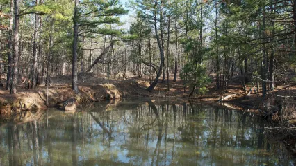
Although the WMA is extremely rocky and in places steep, the network of roads belies the rugged terrain The roads on McGee Creek are smooth and wide with numerous parking areas located throughout the area. Of particular note are two scenic pull-offs, which overlook McGee Creek Lake. The stunning images captured at these strategic vantage points have been featured numerous times within "Outdoor Oklahoma" magazine and TV show.
Description of Wildlife Management Practices
Like many other management areas around the state, McGee Creek WMA has benefited from long-term studies conducted on nearby Pushmataha WMA. For more than 15 years, several experimental "study" plots have been manipulated by prescribed burning on various time-span rotations. Through the research at Pushmataha WMA, it's been found that a burning rotation of once every three years provides not only game species such as deer and turkey with optimum food and cover, but a I so benefits many non-game species as well. This management strategy has been applied very effectively at McGee Creek WMA. The goal of biologists is to burn approximately 1/3 of the entire area annually, which results in the optimum three-year burn cycle.
In addition, approximately 50 acres of wildlife habitat plots are maintained and planted annually. While these plots don't provide a significant food source to the overall health of game populations, these plots do at times concentrate available game species.
Camping and Facilities
One designated primitive camping area is offered on the area. Additional camping and cabin rental can be obtained through the McGee Creek State Park (580) 889-5822 while both lodging and restaurants are available in Atoka and McAlester. The Atoka City Hall can be reached at (580) 889-3341.
Fishing Opportunities
One could easily write an entire separate article on the outstanding fishing at McGee Creek Lake. Through stockings of Florida largemouth bass, the lake has gained a reputation as one of Oklahoma's top lakes for springtime trophy bass. Catfish and crappie are also good bets on the scenic reservoir.
Vital Statistics
- 10,000 total acres
- The terrain within the WMA ranges from steep to moderately steep. Vegetation consists of primarily oak-pine forests. The average precipitation of the area is about 52 inches annually.
- McGee Creek WMA is situated in southcentral Atoka County. Located 11 miles east of Stringtown on Greasy Bend road.